 |
|

|
|
Certification


- I'm Online Chat Now
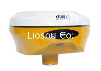
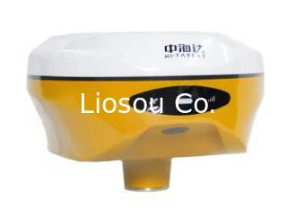
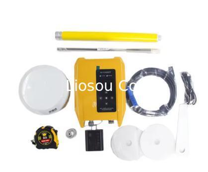
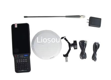
V300 GNSS RTK System Visual GNSS RTK GPS
|
Product Details:
Payment & Shipping Terms:
|
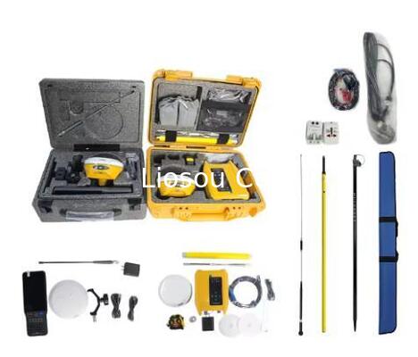
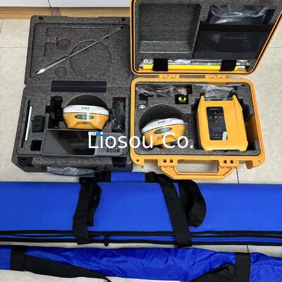
Detailed Product Description
| Specification: | Model V300, 1408 Channels | Real-time Kinematic Precision: | 8 Mm H/ 15 Mm V |
|---|---|---|---|
| Signal Tracking: | GPS,GLONASS,Galileo,BDS QZSS, SBAS,NavlC | Receive & Transmit: | Support Multi-protocol Radio |
| Tilt Survey Performance: | 8 Mm +0.7 Mm / °tilt |
V300 GNSS RTK System Visual GNSS RTK GPS

Equipped with an upgraded high-definition starlight camera, V300 brings out an excellent visual stakeout experience in low-light conditions. The compact and lightweight design, 24 Hours Ultra-Long battery life make V300 a feasible and portable choice for surveyors and engineers in collecting data and improving position accuracy.
Better visual Stakeout Experience
– Visual positioning technology to find points with ease. The combination of virtual and reality by overlaying the design files with the real scene improves stakeout efficiency.
– Professional-grade starlight night vision HD camera with wide angle. Excellent performance and algorithm in tracking signals, achieving an accuracy of up to 1cm.
– Seamless switch of 360-degree AR stakeout between the handheld controller and the rover brings out immersive stakeout experiences making stakeout fast and accurate.
Built-in High-Precision Tilt Survey
– Based on the new generation of IMU, initialization occurs automatically at the startup without obtaining a fixed solution.
– Measure as reaching the point, efficient and convenient.
– Stable performance for reliable results.
Full Constellation and Full Frequency
– Advanced GNSS SoC chip features 1408 channels, supporting new frequency points B1C, B2a, and B2b RTK decoding for Beidou-3 Satellites.
– Multi-frequency interference detection technology and multi-stage adaptive filtering technology with a strong signal, good data, fast fixed procedure, and high accuracy.
Specification :
| GNSS Configuration | Number of channels | 1408 |
| BDS | B1I,B2I,B3I,B1C,B2a,B2b | |
| GPS | L1C/A,L1C,L2P(Y),L2C,L5 | |
| GLONASS | ||
| GALILEO | E1,E5a,E5b | |
| GALILEO | E1,E5a,E5b,E6* | |
| QZSS | L1,L2,L5,L6* | |
| IRNSS | L5* | |
| SBAS | L1,L2,L5 | |
| L-BAND* | ||
| Output format | ASCII: NMEA-0183, binary code | |
| Positioning output frequency | 1Hz~20Hz | |
| Differential support | CMR,RTCM2.X,RTCM3.0,RTCM3.2 | |
| Static format support | GNS, Rinex dual format static data | |
| Differential format | RTCM2.X, RTCM3.X | |
| Network mode | VRS, FKP, MAC; support NTRIP protocol | |
| System Configuration | Operating system | Linux operating system |
| Data storage | Built-in 16GB ROM, supports automatic cycle storage of static data | |
| Precision and Reliability | RTK positioning accuracy | Plane: ±(8+1×10⁻⁶D) mm |
| Elevation: ±(15+1×10⁻⁶D) mm | ||
| Static positioning accuracy | Plane: ±(2.5+0.5×10⁻⁶D) mm | |
| Elevation: ±(5+0.5×10⁻⁶D) mm | ||
| DGPS positioning accuracy | Plane accuracy: ±0.25m+1ppm; | |
| Elevation accuracy: ±0.50m+1ppm | ||
| SBAS positioning accuracy | 0.5m | |
| Tilt measurement accuracy | 8mm+0.7mm/°tilt | |
| Visiual stakeout accuracy | 1cm | |
| Initialization time | <10 seconds | |
| Initialization reliability | >99.99% | |
| RTK keep technology | YES | |
| Camera | Function | Professional star-level night vision high-definition camera, super large viewing angle, support live-view stakeout |
| Communication | Cellular mobile | Built-in 4G network communication: TDD-LTE, FDD-LTE, WCDMA, TD-SCDMA, EDGE,GPRS,GSM |
| I/O Interface | USB type C interface; SMA interface | |
| WiFi | 802.11b/g access point and client mode, can provide WiFi hotspot service | |
| Bluetooth | Bluetooth® 2.4GHz, BT5.2 | |
| NFC | Support NFC IGRS | |
| Power | 1W/2W/5W adjustable | |
| RK/TK internal UHF radio | 0.5W/1W/2W adjustable 410MHz~470MHz |
|
| HI-TARGET,TRIMTALK450S,TRIMMARKIII, TRANSEOT,SOUTH,CHC,SATEL | ||
| 116 frequency bands adjustable | ||
| Sensor | Electronic Bubbles | Realize Smart Alignment |
| Tilt measurement | IMU | |
| User Interface | Panel | Single button |
| Indicator light | Satellite lights, signal lights, power lights | |
| Electrical physical properties | battery | High capacity lithium battery 6800mAh, working time is more than 16 hours |
| Input voltage | USB 15W charger | |
| size | Φ158mm×98mm | |
| weight | ≤1.2kg (including battery) | |
| Environmental characteristics | Dust and water release | IP68 |
| Anti-fall | Resistance to natural drop of 2 meters | |
| Operating temperature | -40ºC~75ºC | |
| Storage temperature | -55ºC~+85ºC |
Contact Details
Shanghai Liosou Technology Co.Ltd
Contact Person: Ms. Rebecca Zhou
Tel: +86-18221338069
Other Products
-
STONEX S6II Gnss Receiver High Performance Professional Stonex Gnss Receiver with High Capacity Battery
-
High Precision Survey Instruments Stonex S9II GNSS RTK GPS Receiver Base and Rover with UM980 main board and 1408 channels Tilt sensor IMU function
-
Stonex S3AR Gnss Rtk Receiver GPS Surveying Instrument Ar Lofting GPS Rtk
-
Global version FOIF A98L 1408 channels laser AR function gnss rtk topographic equipment
-
New Model Foif A66MAX GNSS RTK Laser GPS Receiver for Construction
-
Hi-Target V98 RTK GNSS RTK GPS Receiver with UHF Radio for Engineering Survey and Stakeout with Removable Battery