 |
|

|
|
Certification


- I'm Online Chat Now
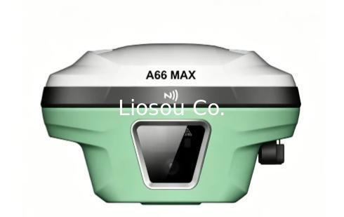
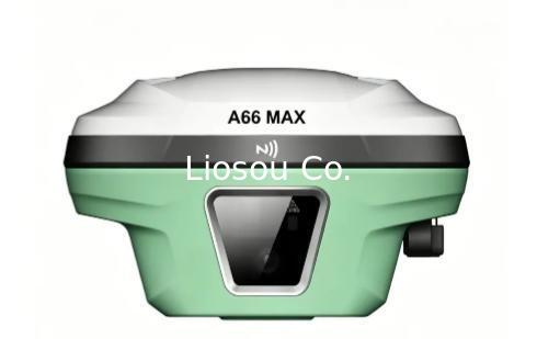
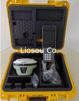
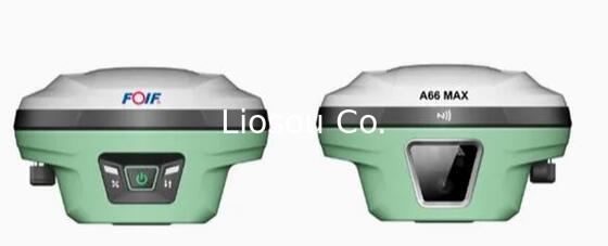
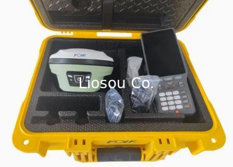
New Model Foif A66MAX GNSS RTK Laser GPS Receiver for Construction
Product Details:
Payment & Shipping Terms:
|
Detailed Product Description
| Features: | Visible Laser With A Measuring Range Of 0.1–60m And A 5–20Hz Refresh Rate For Laser Stakeout. | Name And Model: | A66MAX |
|---|---|---|---|
| Horizontal: | 2.5mm+0.5ppm RMS | Vertical: | 5mm+0.5ppm RMS |
| Transport Package: | Case And Carton | Channels: | 1408 |
| IMU: | Yes | Mian Board: | UM980 |
New Model Foif A66MAX GNSS RTK Laser GPS Receiver for Construction

Product Introduction
FOIF A66MAX is a brand-new laser GNSS receiver integrating professional satellite tracking, laser positioning, tilt survey and intelligent control technologies. It supports full-system satellite tracking (GPS, GLONASS, Galileo, Beidou) and is equipped with a high-performance tilt sensor, Wi-Fi WebUI control and Android field software, providing stable, efficient and user-friendly high-precision positioning solutions for field surveying work.
Application Scenarios
1. Topographic surveying and mapping
2.Engineering construction and stakeout
3.Cadastral survey and asset inventory
4.Road, bridge and pipeline surveying
5.Geographic information collection (GIS)
6.Harsh outdoor field measurement
Key Configurations
1. Built-in laser positioning technology for fast and accurate target measurement
2.Full-system GNSS tracking (GPS, GLONASS, Galileo, Beidou) for stable high-precision positioning
3.Advanced tilt sensor supporting dynamic tilt survey up to 60° with fast initialization
4.Wi-Fi connection for WebUI remote control and real-time status monitoring
5.Bundled Android field software for greatly improved operation experience
IP68 rugged design with magnesium aluminum alloy body for reliable outdoor use
6.High-definition camera (1920*1080) supporting visual auxiliary survey
Compatible with mainstream protocols (TrimTalk450s, TrimMark III, Farlink, etc.)
Bundled Android field software brings a big change in user experience and accessibility.
| Satellite System |
NAVIC (IRNSS): L5 SBAS: L1C/A PPP: B2B-PPP/ E6 - HAS |
| Data update fequency | Supports 50Hz output |
| Positioning frequency | 1Hz 2Hz 5Hz 10Hz 20Hz 50Hz |
| Cold start | <12 seconds |
| Initialization time | <5 seconds |
| Initialization reliability | >99.9% |
| Tilt survey accuracy | ≤2cm within 60° tilt |
| Time accuracy | 20ns |
| RTK accuracy |
H: ±8.0mm +1ppm V: ±15..0mm +1ppm |
| Static accuracy |
H: ±2.5mm +0.5ppm V: ±5..0mm +0.5ppm |
| Single point accuracy |
H: 1.5m V: 2.5m |
| Differential accuracy |
H: 0.4m V: 0.8m |
| Laser module | |
| Laser ranging distance | 0.1~50m |
| Laser ranging resolution | 1mm |
| Laser ranging accuracy | 2mm@1 |
| Laser Measurement | 2cm within 5m/3cm within 10m When IMU reaches the optimal intialization state |
| Battery | |
| Battery life | Static 20H, Rover 16H, Base 10H |
| Power supply | 9V/2A, 5V/2A MAX 18W, 3.6V. 13600mAh |
| Physical | |
| Shell material | Magnesium aluminum alloy |
| Button | Power button |
| Indicator | Satellites, datalink, battery |
| Operating temperature | -30ºC~ +65ºC |
| Storage temperature | -40ºC~ +80ºC |
| Water / dust proof | IP68 |
| Operating humidity | 99.90% non-condensing |
| Shock | 1.8m pole drop resistant in normal temperature |
| System | |
| Operation system | Linux |
| Internal memory | 8GB |
| Data transmission | 4G/ Bluetooth/ Wifi/ Radio |
| Bluetooth | V5.0, BLE |
| Wifi | 802.11a/b/g/n |
| Radio | 1W |
| Radio frequency | 410-470MHZ |
| Air baudrate | 19200, 9600, 4800 |
| Supported protocol | TrimTalk450s(T), TrimMark III, South, PCC-EOT, Hi-target, Satel, Farlink, etc |
| Supported language | Chinese, English, Turkish, Polish, Korean, Indonesian, Spanish, Telugu, Russian, etc |
| Camera | |
| Number of lenses | 2 |
| Lens field of view | 83.4 degree (front/bottom) |
| Sensor pixel | 2 megapixel (front/bottom) |
| Camera focal length | 5m(front), 2m (bottom) |
| Sensor resolution | 1920*1080 |
Contact Details
Shanghai Liosou Technology Co.Ltd
Contact Person: Ms. Rebecca Zhou
Tel: +86-18221338069
Other Products
-
STONEX S6II Gnss Receiver High Performance Professional Stonex Gnss Receiver with High Capacity Battery
-
High Precision Survey Instruments Stonex S9II GNSS RTK GPS Receiver Base and Rover with UM980 main board and 1408 channels Tilt sensor IMU function
-
Stonex S3AR Gnss Rtk Receiver GPS Surveying Instrument Ar Lofting GPS Rtk
-
Global version FOIF A98L 1408 channels laser AR function gnss rtk topographic equipment
-
Hi-Target V98 RTK GNSS RTK GPS Receiver with UHF Radio for Engineering Survey and Stakeout with Removable Battery
-
Hi-target VRTK2/VRTK GNSS RTK GPS Dual Cameras for Image Survey and Live View Stakeout