 |
|

|
|
Certification


- I'm Online Chat Now
Hi-Target V98 RTK GNSS RTK GPS Receiver with UHF Radio for Engineering Survey and Stakeout with Removable Battery
Product Details:
Payment & Shipping Terms:
|

Detailed Product Description
| Tilt Survey Accuracy: | 8mm+0.7mm/°tilt | Signal Tracking: | BDS/GPS/GLONASS/GALILEO/ QZSS/NavlC/SBAS |
|---|---|---|---|
| Image Stakeout Accuracy: | 2cm | Image Survey Accuracy: | 2cm ~ 4cm |
| Data Storage: | Built-in 8GB ROM |
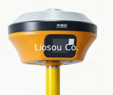
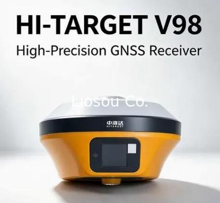
Hi-Target V98 RTK GNSS RTK GPS Receiver with UHF Radio for Engineering Survey and Stakeout with Removable Battery

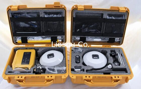
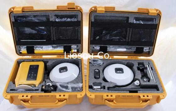
Hi target V98 Base and Rover Full Set
The Hi Target V98 Base and Rover configuration is RTK surveying equipment that combines a reference receiver with a mobile receiver for GNSS RTK work. The Rover includes a standard handheld controller. It supports land surveying, construction layout and control point work.
The internal UHF radio can receive and transmit from 403 to 473 MHz with adjustable 1 W, 2 W or 4 W power. It provides 116 channels, including 16 configurable channels, and lists HI-TARGET, TRIMTALK450S, TRIMMARKIII, SOUTH, CHC and SATEL protocols. Settings should be checked for the planned link.
NTRIP with VRS, FKP and MAC supports network correction workflows. Built-in 4G, Wi-Fi and Bluetooth connect the RTK GPS system. The Rover IMU supplies automatic detection and intelligent tilt compensation, helping the pole approach points where vertical positioning is inconvenient.
Each receiver weighs no more than 1.3 kg with battery. IP68 protection, resistance to a 2 m drop and operation from -40°C to +75°C support outdoor deployment. Operating time is listed from 6.5 to 24 hours and varies by mode.
Before ordering, the sales team can confirm the Base and Rover contents, controller details and radio or network correction method. Product training, software configuration and remote troubleshooting are available to reduce setup uncertainty and keep surveying work moving.
SPECIFICATIONS
| Satellites Signals Tracked Simultaneously | |
| Channel | 336 |
| GPS | L1C/A, L2C, L2E, L5 |
| Glonass | L1C/A, L1P, L2C/A, L3, CDMA |
| SBAS | L1C/A, L5(QZSS, WAAS, MSAS, GAGAN) |
| Galileo | E1, E5A, E5B, E5AltBOC, E6 |
| BeiDou | B1, B2, B3 |
| IRNSS | L5 |
| Global correction service | Hi-RTP(optional) |
| High- precision static Gnss Surveying | |
| Horizontal | 2.5mm+0.1ppm RMS |
| Vertical | 3.5mm+0.4ppm RMS |
| Post Processing Kinematic (PPK/Stop & Go) | |
| Horizontal | 2.5mm+0.1ppm RMS |
| Vertical | 2.5mm+0.1ppm RMS |
| initialization time | Typically 10 min for base and 5 min for rover |
| initialization reliablity | Typically>99.9% |
| Code Differential GNSS Positioning | |
| Horizontal | 25cm+1ppm RMS |
| Vertical | 50cm+1ppm RMS |
| SBAS | 0.5m(H), 0.85m(V) |
| Real time Kinematic (PPK/Stop & Go)GNSS Surveying | |
| Single Base | |
| Horizontal | 8mm+1ppm RMS |
| Vertical | 15mm+1ppm RMS |
| Network RTK | |
| Horizontal | 8mm+0.5ppm RMS |
| Vertical | 15mm+0.5ppm RMS |
| initialization time | Typically 2-10 seconds |
| initialization reliablity | Typically>99.9% |
| Network Communication | |
| Full band support for cellular mobile network(LTE, WCDMA, EDGE, GPRS, GSM) 2.4GHz WIFI, supports 802.11b/g/n. Network RTK (in CORS) range is 20-50km | |
| Hi-Target internal UHF Radio(Standard) | |
| Frequency | 403-473MHz |
| transmitting power | 1~4w Hi-Target Advanced Radio |
| Supports multiple protocols: Hi-Target, Trimtalk450S, trimmarkIII, Transeot, satel-3AS, etc | |
| working range | 3-5km typical, 5-8km optimal |
| Hi-Target external UHF Radio(Standdard) | |
| Frequency | 410-470MHz |
| transmitting power | 5w-25w, compatible with third party radio |
| Working Range | Typically 8-10km, optimal 15-20km |
| External Power | |
| 6-28V DC external power input (5-pin port) with over-charge protection | |
| Power consumption | 4.2W |
| Dimensions(W*H) | 164mm*83.5mm |
| Weight | ≤1.4kg (includes battery) |
| Data Storage | 8G internal storage |
| Tilt Survey Performance | |
| 2cm accuracy in the inclination of 30 degree | |
| HARDWARE | |
| Physical | |
| Dimmensions(W*H) | 158mm*98mm(6.22 inch*3.86 inch) |
| Weight | lighter than 1.3kg (2.65Ib) within internal battery |
| Operating temperature | -40ºC~+75ºC |
| Storage temperature | -50ºC~+85ºC |
| Humidity | 100%, considering |
| Water/ Dustproof | IP67 dustproof, protected from temporary immersion to depth of 1m (3.28ft) |
| Shock & Vibration | MIL-STD-810G, 514.6 |
| Anti-salt spary | MIL-STD-810G, 509.4, 96h |
| Free fall | MIL-STD-810G, 516.6, designed to survive a 2m natural fall onto concrete |
| Electrical | |
| 6V to 28V DC external power input (5-pin port), with over discharge protection power consumption 4.4W Automatic switching between internal power and external power. | |
| Control Panel | |
| Physical button ×1 | |
| Display: 240*240 pixel, 261 ppi | |
| Touchscreen: support glove mode and wet-finger mode | |
| Internal Battery | |
| 7.4V, 6800mAh lithium-ion rechargeable and removeable battery RTK rover (UHF/Cellular) for 10 hours, Power indicator embedded, quick charge within 3.5 hours | |
| I/O interface | |
| Bluetooth 4.0/2.1+EDR, 2.4GHz, USB2.0 port with OTG function. Near Field Communication (NFC) | |
| SMA antenna connector | ×1 |
| DC Power input (5-pin) | ×1 |
| SIM card slot | ×1 |
| Data Formats | |
| 1Hz positioninng Output, up to 50Hz. CMR, RTCM2.X, RTCM3.0, RTCM3.1, RTCM3.2. Navigation outputs ASCII NMEA-0183, GSV, AVR, RMC, HDT, VGK, VHD, ROT, GGK, GGA, GSA,ZDA, VTG, GST, PJT, PJK, BPQ, GLL, GRS, GBS, Binary: Trimble GSOF, NMEA2000 | |
Contact Details
Shanghai Liosou Technology Co.Ltd
Contact Person: Ms. Rebecca Zhou
Tel: +86-18221338069
Other Products
-
STONEX S6II Gnss Receiver High Performance Professional Stonex Gnss Receiver with High Capacity Battery
-
High Precision Survey Instruments Stonex S9II GNSS RTK GPS Receiver Base and Rover with UM980 main board and 1408 channels Tilt sensor IMU function
-
Stonex S3AR Gnss Rtk Receiver GPS Surveying Instrument Ar Lofting GPS Rtk
-
Global version FOIF A98L 1408 channels laser AR function gnss rtk topographic equipment
-
New Model Foif A66MAX GNSS RTK Laser GPS Receiver for Construction
-
Hi-target VRTK2/VRTK GNSS RTK GPS Dual Cameras for Image Survey and Live View Stakeout