 |
|

|
|
Certification


- I'm Online Chat Now
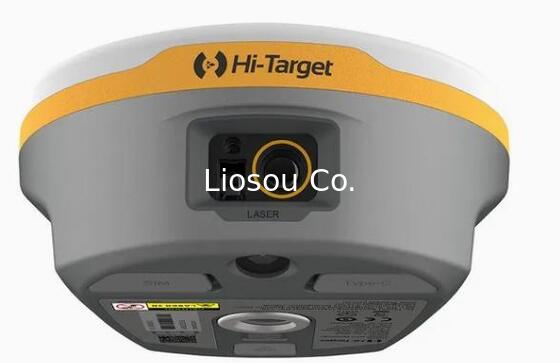
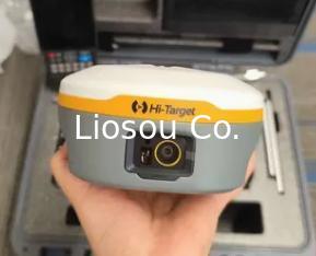
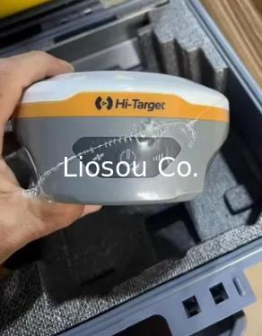
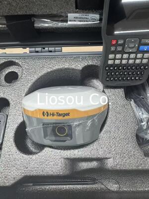
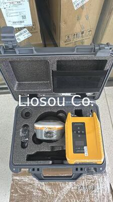
Hi Target V600L Laser Rtk GPS Gnss Receiver for Topographic Survey Compatible with Dual Camera Laser GPS
Product Details:
Payment & Shipping Terms:
|


Detailed Product Description
| Main Function: | Ar Stakeout Land Survey Engineering Measurement | Galileo: | E1, E5a, E5b. E6 |
|---|---|---|---|
| GPS: | L1c/a, L1c, L2p(Y), L2c, L5 | Glonaes: | L1, L2, L3 |
| Operating Temperature: | 45°C T0 75°C | Protection Grade: | IP68 Waterproof |
| Specification: | Model V600L, 1408 Channels |
Hi Target V600L Laser Rtk GPS Gnss Receiver for Topographic Survey Compatible with Dual Camera Laser GPS Rtk

V600L Laser RTK System
Hi-Target's next-generation Laser RTK combines high-precision laser surveying, visual targeting, and automotive-grade IMU to deliver fast, non-contact measurements-even in GNSS-denied environments such as under bridges, inside fenced zones, or across ditches. With a built-in LoRa radio offering a working range of over 15 km, it achieves up to 2 cm accuracy, significantly improving field efficiency for safer, faster, and more reliable measurements in complex terrain.
Product Parameters
| GNSS Signal[1] | Channel | 1408 | |||
| GPS | L1C/A, L1C, L2P(Y), L2C, L5 | ||||
| BDS | B1I, B2I, B3I, B1C, B2a, B2b | ||||
| GLONASS | L1, L2, L3 | ||||
| GALILEO | E1, E5a, E5b, E6 | ||||
| QZSS | L1, L2, L5, L6* | ||||
| NavIC | L5 | ||||
| SBAS | L1, L2, L5 | ||||
| PPP | B2b-PPP, Galileo E6-HAS | ||||
| Positioning Performance[2] | High-Precision Static | H: 2.5 mm + 0.1 ppm RMS | V: 3.5 mm + 0.4 ppm RMS | ||
| Static and Fast Static | H: 2.5 mm + 0.5 ppm RMS | V: 5 mm + 0.5 ppm RMS | |||
| Post Processing Kinematic (PPK / Stop & Go) |
H: 8 mm + 1 ppm RMS | V: 15 mm + 1 ppm RMS | |||
| Initialization time: typically 10 min for base and 5 min for rover Initialization reliability: typically>99.9% |
|||||
| PPP | H: 10 cm | V: 20 cm | |||
| Code Differential GNSS Positioning | H: ±0.25 m+1 ppm RMS SBAS: 0.5 m (H), 0.85 m (V) | V: ±0.5 m+1 ppm RMS | |||
| Real Time Kinematic (RTK) | H: 8 mm+1 ppm RMS Initialization time: typically < 10 s | V:15 mm+1 ppm RMS Initialization reliability: typically > 99.9% |
|||
| Hi-Fix[3] | H: RTK+10 mm / minute RMS | V:RTK+20 mm / minute RMS | |||
| Time to First Fix[4] | Cold start: < 45 s | Hot start: < 30 s | Signal re-acquisition: < 2 s | ||
| Positioning Rate | 1 Hz, 5 Hz and 10 Hz | ||||
| Tilt Survey Performance | 200 Hz, auto calibration, additional horizontal pole-tilt uncertainty typically less than H: 8 mm+0.7 mm/°tilt(0~60°); V: 15 mm+0.7 mm/°tilt (0~60°) | ||||
| Image Stakeout Accuracy | 2 cm accuracy | ||||
| Laser Measurement | 2 cm accuracy within 10 m | ||||
| Physical | Dimensions (W x H) | 130.97 mm × 68.7 mm | |||
| Weight | ≤ 0.73 kg ( 1.61 lb ) | ||||
| Operation Temperature | -40ºC ~ +75ºC (-40°F~ +167°F) | ||||
| Storage Temperature | -55ºC ~ +85ºC(-67°F ~ +185°F) | ||||
| Humidity | 100% non-condensing | ||||
| IP Rating | IP68 ( according to lEC 60529 ) | ||||
| Shock and Vibration | MIL-STD-810G, 514.6 | ||||
| Free Fall | Designed to survive a 1.8 m natural fall onto concrete | ||||
| Electrical | Internal Battery[5] | RTK rover(UHF/GSM): up to 20 h; UHF RTK Base: up to 13 h; GSM RTK Base: up to 17 h | |||
| External Power | using standard smartphone chargers or external power banks (Support 5V 2.8A Type-C USB external charging) | ||||
| Communication | I/O Interface | 1 × USB type C port; 1 × SMA antenna port, 1 × Nano SIM card slot | |||
| Wi-Fi | Frequency 2.4 GHz, supports 802.11 a/b/g/n/ac/ax | ||||
| Bluetooth | BT 5.2, 2.4 GHz | ||||
| NFC | Near field communication for device touch pairing | ||||
| Network Modem | TDD-LTE, FDD-LTE, GSM | ||||
| Internal UHF Radio | Power: 1 W / 1.5 W adjustable | ||||
| Frequence: 410 MHz~470 MHz | |||||
| Protocol: LoRa, HI-TARGET, TRIMTALK450S, TRIMMARK III, SATEL-3AS, TRANSEOT, etc. | |||||
| Working range: 15-20 km[6] | |||||
| Channel: 116 (16 scalable) | |||||
| Laser | Laser Product Classification | Class 3R | |||
| Camera | Front Camera | Support image-assisted measurement and AR stakeout | |||
| Bottom Camera | Support AR stakeout | ||||
| Control Panel | Physical Button | 1 | |||
| LED Lights | Satellite, signal, power | ||||
| System Configuration | Storage | 64 GB ROM internal storage | |||
| Output Format | ASCII: NMEA-0183 | ||||
| Output Rate | 1Hz~20Hz | ||||
Contact Details
Shanghai Liosou Technology Co.Ltd
Contact Person: Ms. Rebecca Zhou
Tel: +86-18221338069
Other Products
-
STONEX S6II Gnss Receiver High Performance Professional Stonex Gnss Receiver with High Capacity Battery
-
High Precision Survey Instruments Stonex S9II GNSS RTK GPS Receiver Base and Rover with UM980 main board and 1408 channels Tilt sensor IMU function
-
Stonex S3AR Gnss Rtk Receiver GPS Surveying Instrument Ar Lofting GPS Rtk
-
Global version FOIF A98L 1408 channels laser AR function gnss rtk topographic equipment
-
New Model Foif A66MAX GNSS RTK Laser GPS Receiver for Construction
-
Hi-Target V98 RTK GNSS RTK GPS Receiver with UHF Radio for Engineering Survey and Stakeout with Removable Battery