 |
|

|
|
Certification


- I'm Online Chat Now
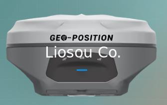
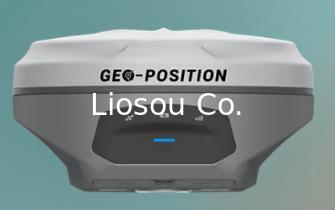
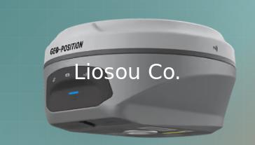
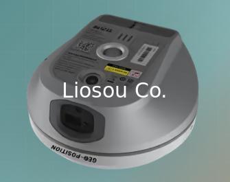
GEO-POSITION G10L long range laser GNSS RTK GPS receiver
|
Product Details:
Payment & Shipping Terms:
|
Detailed Product Description
| Available: | Hard Plastic Case | Channels: | 1408 |
|---|---|---|---|
| IMUT Tilt Sensor: | Yes | HS Code: | 8526919090 |
| Package Size: | 55cm * 45cm * 70cm | Package Gross Weight: | 30kg |
| Laser: | Yes |
GEO-POSITION G10L long range laser GNSS RTK GPS receiver GNSS, IMU, dual-camera imaging, and visible laser technology for immersive

GEO-POSITION G10L combines GNSS, IMU, dual-camera imaging, and visible laser technology in a compact receiver for precise, safer fieldwork across obstructed or semi-enclosed environments.
A next-generation laser RTK receiver that combines GNSS, IMU, dual-camera imaging, and visible laser technology for immersive, efficient, and precise fieldwork in obstructed, complex, or semi-enclosed terrain.
Overview
G10L is a calibration-free long-range laser GNSS receiver built for riverine stakeout, bridge pile surveying, elevation surveying, municipal surveying, and outdoor and indoor combination surveying. Visualized laser targeting and non-contact measurement improve accessibility and safety, while dual cameras support image-assisted laser aiming, real-scene CAD stakeout, and AR stakeout.
Key Features
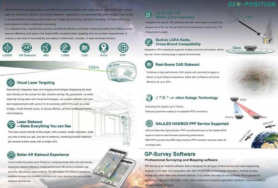
1. Up to 120° tilt measurement with calibration-free IMU technology keeps G10L fixed for work at extreme measurement angles.
2. Visual Laser Targeting seamlessly integrates laser and imaging technologies, displaying the laser spot on screen for fast, intuitive aiming.
3. Laser Stakeout points directly at visible targets, enabling precise stakeout several meters away with a single click.
4. Better AR Stakeout overlays design files onto real scenes and switches between handheld controller and rover for fast, accurate work.
5. Real-Scene CAD Stakeout combines a high-performance CAD engine with real-world imagery and can boost efficiency by up to 50%.
6. Built-in LORA radio supports multiple protocols and brands with over 15km working range in typical environments.
7. G-Fix Correction Outage Technology extends the RTK Fix solution for up to 10 minutes, reducing downtime while corrections reconnect.
8. Galileo HAS and BDS PPP provide free high-precision PPP correction services for improved real-time positioning.
9. Rodless laser measurement improves efficiency and reduces risk in under-bridge, fenced, ditch-side, and other difficult environments.
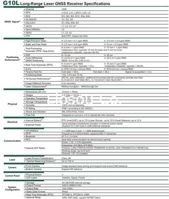
10. The G10L uses calibration-free IMU technology for tilt measurement up to 120°. Its specified tilt survey performance is H: 8mm + 0.7mm/° and V: 15mm + 0.7mm/° from 0° to 60°.
11. The G10L delivers RMS ≤2.5cm at 5m and RMS ≤5cm at 10m. Its optimal measuring distance can reach up to 100m under favourable conditions.
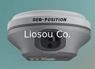
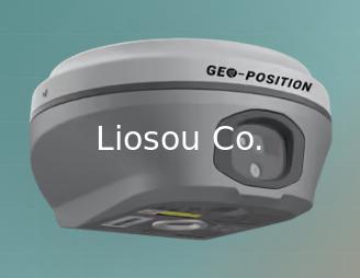
12. The front camera supports image-assisted laser aiming and real-scene CAD stakeout, while the bottom camera supports AR stakeout.
13. The G10L has an adjustable 1W/1.5W UHF radio with LoRa and other multi-brand protocols, delivering up to 15km working range in typical environments.
14. The G10L runs up to 13 hours as an RTK rover with UHF, up to 10 hours for laser survey, and up to 12 hours for visual stakeout.
Specifications
|
GNSS Engine
|
1408 channels; GPS, BDS, GLONASS, Galileo, QZSS, NavIC, SBAS; B2b-PPP and Galileo E6-HAS |
|
RTK Accuracy
|
H: 8mm + 1ppm RMS; V: 15mm + 1ppm RMS |
|
Static Accuracy
|
H: 2.5mm + 0.1ppm RMS; V: 3.5mm + 0.4ppm RMS |
|
Tilt Survey
|
200Hz auto-calibration; H: 8mm + 0.7mm/° tilt, V: 15mm + 0.7mm/° tilt from 0° to 60°; calibration-free IMU supports up to 120° tilt |
|
Laser Measurement
|
RMS ≤2.5cm @5m; RMS ≤5cm @10m; optimal measuring distance up to 100m |
|
Image Stakeout
|
2cm accuracy with image-assisted aiming and real-scene CAD stakeout |
|
Cameras
|
Front camera for laser aiming and CAD stakeout; bottom camera for AR stakeout |
|
Internal Radio
|
Adjustable 1W / 1.5W UHF; LoRa, TRIMTALK450S, TRIMMARK III, SATEL-3AS, TRANSEOT, HI-TARGET and more; up to 15km |
|
Connectivity
|
Wi-Fi 2.4GHz/5.8GHz, Bluetooth 5.2, NFC, USB Type-C, and SMA antenna port |
|
Physical
|
131mm × 70mm; ≤0.74kg; IP68; designed to survive a 1.8m natural fall onto concrete |
|
Battery
|
RTK rover with UHF up to 13h; Laser Survey up to 10h; Visual Stakeout up to 12h |
|
System
|
64GB internal storage; NMEA-0183, RINEX, RTCM2.X/3.X, CMR; VRS, FKP, MAC and NTRIP Client |
Contact Details
Shanghai Liosou Technology Co.Ltd
Contact Person: Ms. Rebecca Zhou
Tel: +86-18221338069
Other Products
-
South Inno5 Base and Rover GPS Receiver Rtk Surveying Instrument Gnss GPS Rtk with Upgradable Survstar Software&Firmware
-
South Inno4 Gnss GPS Rtk Surveying Equipment International Module Multilingual Gnss Rtk
-
South INNO3 1898 Channel RTK with 200m Laser Measurement GNSS RTK Receiver
-
Newest South Alps2 Gnss 1698-Channel +Ar Stakeout for Remote Measuring Receiver
-
South Alps1 1698-Channels Laser Rtk+Ar Stakeout Dual Camer+Screen for Surveing Gnss Receiver
-
GEO-POSITION G12Pro long range laser GNSS RTK GPS receiver