 |
|
|
|
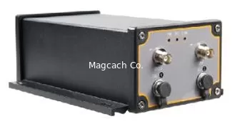
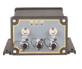
ComNav M300 GNSS Receiver
|
Product Details:
Payment & Shipping Terms:
|
| Signal Tracking Channels:: | 496 Channels | Satellite Tracking:: | GPS, BeiDou, GLONASS, Galileo And SBAS |
|---|---|---|---|
| RTK Horizontal Accuracy:: | 8mm+1ppm | RTK Vertical Accuracy:: | 15mm+1ppm |
| Full-constellation Tracking: | The M300 Tracks 496 Channels With All Working And Planned GNSS Constellations Including GPS, GLONASS, BeiDou, Galileo And SBAS. |
M300 GNSS Receiver
The M300 GNSS Receiver is a multi-purpose device for high-precision GNSS applications featuring full-constellation tracking, for centimeter accuracy survey on demand.
![]()
Features
GPS L1/L2/L5, BeiDou B1/B2/B3,GLONASS L1/L2, Galileo E1/E5a/E5b
DP-Filter Smooth Function
Support PPS and Event Marker
Easy to Intergrate
Advanced QUANTUM Technology
![]()
|
Full-constellation tracking
|
The M300 tracks 496 channels with all working and planned GNSS constellations including GPS, GLONASS, BeiDou, Galileo and SBAS. |
|
Easy to Integrate
|
With its T-type structure, you are flexible to integrate more modular based on your requirement, such as all kind of K-serials OEM Boards, UHF and Ethernet.
|
|
|
Its built-in 2000 V optoelectronic isolator protects it from lightning strike, and rugged housing ensures you complete survey tasks even in extremely harsh environments.
|
| Performance | |
| Signal tracking Channels: | 496 channels |
| Satellite tracking: | GPS, BeiDou, GLONASS, Galileo and SBAS |
| RTK Horizontal accuracy: | 8mm+1ppm |
| RTK Vertical accuracy: | 15mm+1ppm |
| Post Processing Horizontal accuracy: | 2.5mm+0.5ppm |
| Post Processing Vertical accuracy: | 5mm+0.5ppm |
| RTK Initialization time: | less than 10s |
| Physical | |
| Size (L × W × H): | 200 mm × 145 mm × 80 mm |
| Weight (incl. supplied two batteries): | 1 kg with internal UHF |
| Operating temperature: | -40 °C to + 70 °C |
| Shock: | Designed to survive a 2 m drop onto concrete |
| Humidity: | 95% no condensation |
| Waterproof and dustproof: | IP67 |
| Power consumption (3 constellations): | 2.5 W |
| External power input: | 10.5-28 VDC |
| Communications | |
| 1 Serial port (7 pin Lemo): | 921,600 bps |
| Correction data I/O: | RTCM 2.X, 3.X, CMR, CMR+ |
| Position data output rates: | 1 Hz, 2 Hz, 5 Hz, 10 Hz, 20 Hz, 50 Hz |
| Ethernet (Optional): | Tx/Rx, 410-470 MHz |
Contact Person: Ms. Rebecca Zhou
Tel: +86-18221338069
-
Bluetooth Connectivity and Multi-language Support for Hi target GPS GNSS RTK reciever
-
r-Responsive GPS with Voice Guidance and Customizable Route Planning
-
High-precision FOIF GNSS GPS receiver base rover - Bluetooth Connectivity included
-
Small GPS with Bluetooth Connectivity and Traffic Information for Improved Navigation
-
Efficient CHC GNSS GPS with Small Form Factor and Enhanced POI Search
-
High Precision Classic Gnss Foif A70 PRO Rtk Intelligent Receiver


