|
|
|
|
|
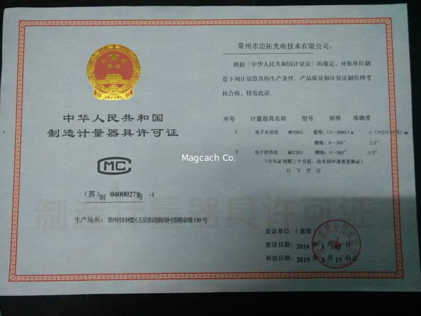
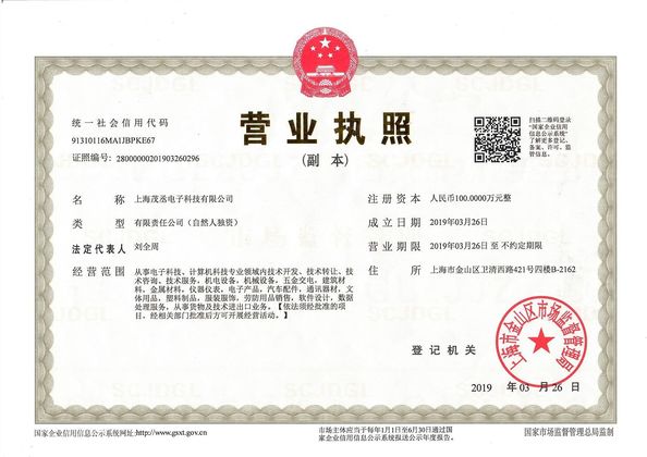
Certification
- I'm Online Chat Now
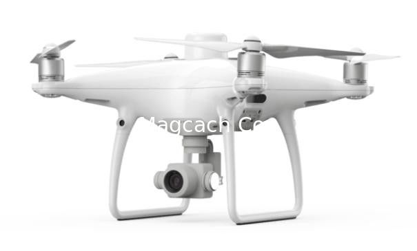
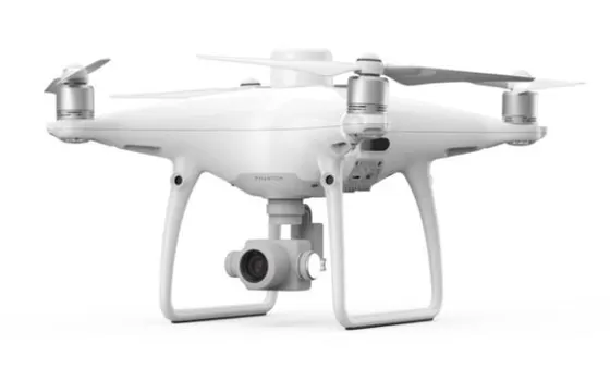
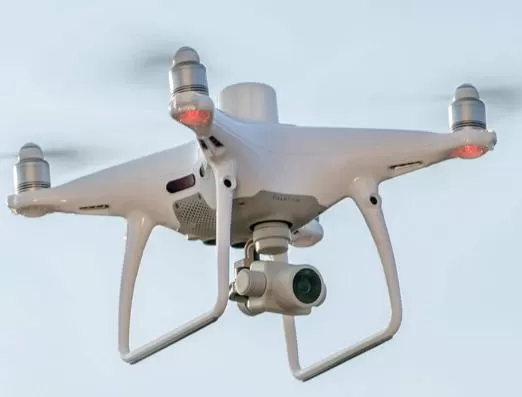
Dji Phantom 4 Rtk Drone/UAV Pantom 4 RTK
|
Product Details:
Payment & Shipping Terms:
|

Detailed Product Description
| Model: | Phantom 4 Rtk Drone / UAV | Trademark: | Dji |
|---|---|---|---|
| Weight: | 3 KG | Original: | China |
Dji Phantom 4 Rtk Drone
![]()
Every inch of it
Spirit Phantom 4 RTK is a small multi-rotor high-precision aerial survey uav, aiming at low-altitude photogrammetry applications, with centimeter-level navigation and positioning system and high-performance imaging system, portable and easy to use, comprehensively improving aerial survey efficiency.
New era of aerial survey
The overall upgrade of the system will improve the accuracy of aerial survey to a new standard, bringing centimeters of accurate data to users. At the same time, the ground control points needed in traditional aerial survey are greatly reduced to simplify the operation process and reduce the time cost.
Specification :
| Aircraft | |
| Weight (including paddle and battery) | 1391 g |
| The wheelbase | 350 mm |
| Maximum take-off altitude | 6000 m |
| Maximum rate of rise | 6 m/s (automatic flight) |
| 5 m/s (manual control) | |
| Maximum rate of descent | 3 m/s |
| Maximum horizontal speed | 50 km/h (positioning mode) |
| 58 km/h (attitude mode) | |
| Maximum tilt Angle | 25° (positioning mode) |
| 35° (attitude mode) | |
| Maximum angular velocity of rotation | 150°/s (attitude mode) |
| Time of flight | About thirty minutes |
| Operating temperature | 0 ℃ and 40 ℃ |
| Working frequency | 2.400ghz to 2.483ghz (Europe, Japan, Korea) |
| 5.725 GHz to 5.850 GHz (China, USA) | |
| Equivalent omni-directional radiated power (EIRP) |
2.4 GHz
CE (Europe)/MIC (Japan)/KCC (Korea) : < 20 dBm |
|
5.8 GHz
SRRC (China)/NCC (Taiwan)/FCC (USA) : < 26 dBm |
|
| Hover precision |
When RTK is enabled and RTK works properly:
Vertical: ± 0.1m; Level: ± 0.1m |
|
RTK not enabled:
Vertical: ± 0.1m (when visual positioning works normally);
± 0.5m (when GNSS positioning is working normally)
Level: ± 0.3m (when visual positioning works normally);
± 1.5m (when GNSS positioning is working normally) |
|
| Image position compensation | Position of camera center relative to phase center of airborne d-rtk antenna, body shaft-system :(36, 0, 192) mm, photo EXIF coordinates have been compensated. The XYZ axis of the body shafting points to the front, right and bottom of the aircraft respectively |
| Figure the functionality | |
| Precision built figure |
It can meet the precision requirements of GB/T 7930-2008 1:500 topographic map aerial photogrammetry specification (referred to as "1:500 specification")
** the actual accuracy is related to many factors such as the ambient lighting, scene texture, flight height and the mapping software used. |
| Ground sampling distance (GSD) |
(H / 36.5) cm/pixel,
H is the flight height of the aircraft relative to the shooting scene (unit: meters) |
| Collection efficiency | The maximum operating area of a single flight is about 1 km2 (flight altitude is 182 m, that is, GSD is about 5 cm/pixel, meeting the 1:500 specification requirements) |
| Controllable rotation range | Pitch: -90° to +30° |
| Velocity range | Flight speed ≤ 14m /s (height: 2m, sufficient light) |
| Height range | 0 - 10 m |
| Precise hover range | 0 - 10 m |
| Obstacle sensing range | 0.7 - 30 m |
| Using the environment |
The surface has rich texture and sufficient lighting conditions
(>15 lux, normal indoor fluorescent lamp irradiation environment) |
| The visual system | |
| Velocity range | Flight speed ≤ 50 km/h (height: 2 meters, sufficient light) |
| Height range | 0 - 10 m |
| Precise hover range | 0 - 10 m |
| Obstacle sensing range | 0.7 - 30 m |
| FOV |
Front/back: 60° horizontal, ±27° vertical
Below: front and rear 70°, left and right 50° |
| Measure the frequency |
Front/back: 10 Hz;
Lower vision: 20 Hz |
| Using the environment | Rich texture on the surface and sufficient illumination conditions (>15 lux, normal indoor fluorescent lamp) |
| The camera | |
| Image sensor | 1 inch CMOS; 20 million effective pixels (20.48 million total pixels) |
| The lens |
FOV 84 °; 8.8mm / 24mm (equivalent format of 35mm);
Aperture f/ 2.8-f /11; With autofocus (focus distance 1 m - infinity) |
| ISO range |
Video: 100-3200 (automatic)
100-6400 (manual);
Photo: 100-3200 (automatic),
100-12800 (manual) |
| Mechanical shutter | 8 - 1/2000 s |
| Electronic shutter | 8 - 1/8000 s |
| Maximum photo resolution | 4864×3648(4:3); 5472×3648(3:2) |
| Video resolution | H.264,4K:3840×2160 30p |
| Overall design frame | 5640×3710 |
| A valid format | 5472×3648 |
| Video maximum code stream | 100 Mbps |
| Photo format | JPEG |
| Video format | MOV |
| File system support | FAT32(≤ 32 GB); exFAT(> 32 GB) |
| Support memory card type | MicroSD card with write speed ≥15 MB/s, transmission speed of Class 10 or above or uhs-1 rating, maximum support capacity of 128 GB |
| Operating temperature | 0 ℃ and 40 ℃ |
| Intelligent flight battery (ph4-5870mah -15.2v) | |
| capacity | 5870 mAh |
| voltage | 15.2 V |
| The battery type | LiPo 4S |
| energy | 89.2 Wh |
| Overall battery weight | 468 g |
| Operating temperature | - 10 ℃ and 40 ℃ |
| Maximum charging power | 160 W |
| Intelligent battery for remote control (wb37-4920maa-7.6v) | |
| capacity | 4920 mAh |
| voltage | 7.6 V |
| The battery type | LiPo 2S |
| energy | 37.39 Wh |
| Operating temperature | - 20 ℃ and 40 ℃ |
| Power adapter (PH4C160) | |
| voltage | 17.4 V |
| Rated power | 160 W |
| GNSS | |
| Single frequency high sensitivity GNSS |
GPS+BeiDou+Galileo (Asian region);
GPS+GLONASS+Galileo (other regions) |
| High precision RTK GNSS for multi - frequency multi - system |
Use frequency points:
GPS: L1 / L2;
GLONASS: L1 / L2;
BeiDou: B1 / B2;
Galileo: E1 / E5
First positioning time: < 50 s
Positioning accuracy: 1.5 cm + 1 PPM (RMS) vertically;
Level 1 cm + 1 PPM (RMS)
1 PPM means that the error of the aircraft increases by 1 mm for every 1 km it moves |
| yuntai | |
| A stable system | 3- axis (pitch, roll, yaw) |
| Controllable rotation range | Pitch: -90° to +30° |
| Maximum control speed | Pitch: 90 ° / s |
| Angular jitter | ±0.02° |
| Infrared sensing system | |
| Obstacle sensing range | 0.2 - 7 m |
| FOV |
The level of 70 °
Vertical plus or minus 10 ° |
| Measure the frequency | 10 Hz |
| Using the environment | The surface is diffuse with a reflectance of > 8% (e.g. walls, trees, people, etc.) |
| The remote control | |
| Working frequency |
2.400ghz to 2.483ghz (Europe, Japan, Korea)
5.725 GHz to 5.850 GHz (China, USA) |
| Equivalent omni-directional radiated power (EIRP) |
2.4 GHz
5.8 GHz |
| Signal maximum effective distance |
FCC: 7 km;
SRRC/CE/MIC/KCC: 5 km (no interference, no shielding) |
| power | 16w (typical value) |
| Display device |
5.5-inch screen, 1920×1080 resolution, 1000 CD /m2 brightness, Android
Memory 4G RAM+16G ROM |
| Operating temperature | 0 ℃ and 40 ℃ |
| PHANTOM 4 CHARING HUB | |
| voltage | 17.5 V |
| Operating temperature | 5 ℃ to 40 ℃ |
| Smart battery charging butler (WCH2) | |
| The input voltage | 17.3 - 26.2 V |
| Output voltage current | 8.7 V,6 A; 5 V,2 A |
| Operating temperature | 5 ℃ to 40 ℃ |
| The SDK remote control | |
| Working frequency |
2.400ghz to 2.483ghz (Europe, Japan, Korea)
5.725 GHz to 5.850 GHz (other countries and regions) |
| Equivalent omni-directional radiated power (EIRP) | 2.4 GHz CE / MIC / KCC: < 20 dBm 5.8 GHz FCC / SRRC / NCC: < 26 dBm |
| Signal maximum effective distance |
FCC/NCC: 7 km;
CE/MIC/KCC/SRRC: 5 km
(no interference, no shielding) |
| Built-in battery | 6000 mAh 2S lithium rechargeable battery |
| Working current/voltage | 1.2 A @ 7.4 V |
| Mobile support | It works on tablets or phones |
| Operating temperature | 0 ° to 40 ° C |
Contact Details
Shanghai Magcach Technology Co.Ltd
Contact Person: Ms. Rebecca Zhou
Tel: +86-18221338069