 |
|
|
|
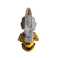
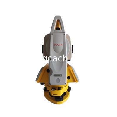
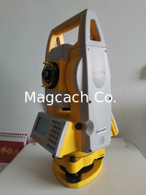
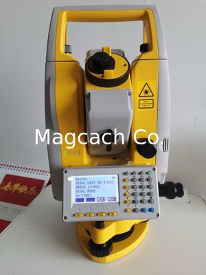
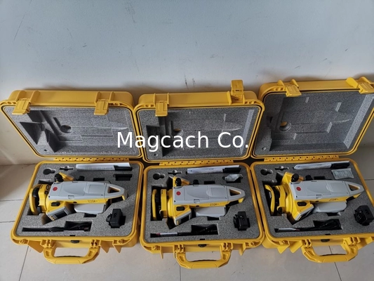
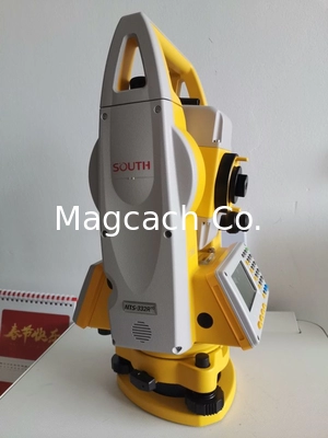
South Total Station NTS-332R10 Total Station with Bluetooth and USB port reflectorless distance 1000m
Product Details:
Payment & Shipping Terms:
|
| Model: | South Total Station NTS-332R10 | Bluetooth: | Yes |
|---|---|---|---|
| USB Port: | Yes | Reflectorless Distance: | 1000m |
| Accuracy: | 2" |
South Total Station NTS-332R10 Total Station
![]()
![]()
China Brand Total Station South NTS332R10 Total Station
MODEL:NTS-332R10
Reflectorless 1000m
SD card and USB Interface
Six-line Large LCD
Road-Design Program
Dual Axis Compensation
3.5-inch LCD
The large LCD screen provides you a better interface. Clearer display, easier operation.
Laser Path Diagram
Upgraded laser path system delivers much longer measuring range
Absolute Encoding Disk
Proved by market, high performance of angle measurement system guaranteed
Dual Axis Compensation
The integrated dual-axis compensator provides automatic error correction for both horizontal and vertical axis, double directions guaranteed
SD Card Function
USB Interface
Automatic Correction of Temperature & Pressure Sensor
Laser Plummet (Optional)
SPECIFICATIONS
| Measuring distance | Single prism: 5.0km |
| Prism free: 1000M | |
| 2C correction of index difference, Software auto calibration | |
| Measurement time : Precise measurement for 0.3s, tracking for 0.1s | |
| Digital display Large: 9999999.9999 small: 1mm/0.1mm (optional) | |
| accuracy Prismatic: 2+2ppm prismatic free: 3+2ppm | |
| Meteorological correction: Automatic correction of input parameters | |
| Prism constant correction: Automatic correction of input parameters | |
| Angle measurement | Angle measuring method : Absolute encoding |
| Code disk diameter: 79mm | |
| The reading can reach 0.1 "/1" /5 "optional | |
| Accuracy: 2" | |
| Detection mode : Horizontal plate: diameter alignment; Vertical disc: alignment | |
| Telescope | Imaging : Positive image |
| Tube length 154mm | |
| Effective aperture of objective lens Telescopic: 45mm; Ranging: 50mm | |
| Magnification: 30x | |
| Field angle : 1°30′ | |
| Resolving power : 3" | |
| Minimum focusing distance : 1.2m | |
| Automatic vertical Compensator | System: photoelectric double axis electronic compensation |
| Scope of work : ± 4 '(± 6' optional) | |
| Resolution: 1 " | |
| Level | Pipe level: 30 "/2mm |
| Circular level: 8 '/2mm | |
| Optical aligner | Imaging: positive image |
| Magnification: 3 × | |
| Focusing range: 0.5m ~ ∞ | |
| Field angle: 5 ° | |
| Laser aligner | Centering accuracy : ±1.5mm |
| brightness : With brightness adjustment function | |
| other | Display type: 2.6 inch screen; Double sided, 6-line English display, one button backlight, clear visibility under strong light |
| Data transmission: U-disk interface, built-in standard Bluetooth | |
| 2C correction of index difference: software automatic correction Airborne battery |
|
| Power supply: rechargeable lithium battery, 3100mah | |
| Voltage : DC 7.4v | |
| Continuous working time: 10 hours | |
| Size and weight | Size :190mm × 190mm × 350mm |
| Weight:5.6kg (waterproof and dustproof grade IP65) |
Company Profile:
Shanghai Magcach Technology Co., LTD is a company to provide professional surveying instruments and surveying service,and with rich experience in export trade business . Our company mainly line in all kinds brand survey instruments ,such as GNSS RTK GPS,Total Station, Auto/digital level, Optical /electronic theodolite, Laser distance meter, Handheld GPS,Surveying accessories, Surveying software, etc.
And we keep good cooperation with surveying accessory manufacturer. The Company's employees graduated from engineering.
We not only supply the Survey Instruments and accessories to our products ,we also supply the after sale and the technic Support. We will take the responsibility on the quality of our products .
Contact Person: Ms. Rebecca Zhou
Tel: +86-18221338069
-
China Brand new Mato Total Station MTS1202R Reflectorless Total Station 500m to 800m
-
China Brand new Mato Total Station MTS602R Reflectorless Total Station 400m to 500m
-
China Brand new Mato Total Station MTS802R Reflectorless Total Station 400m to 500m can be with SD card
-
China Brand FOIF Total Station Rts 352 Windows Ce/ Fieldgenius Software (RTS352/355-R500/R1000)
-
CHC CTS-112R4 Total Station
-
Mato MATO MTS102R Classical Total Station reflectorless Total Station


