|
|
|
|
|
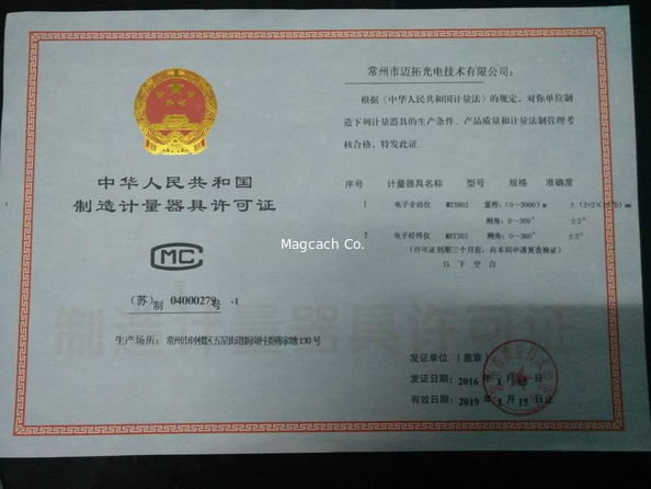
Certification

- I'm Online Chat Now
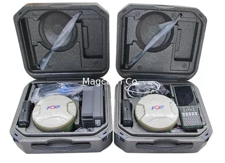
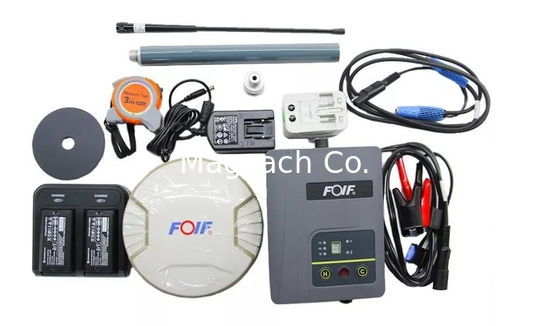
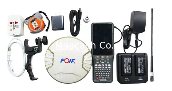
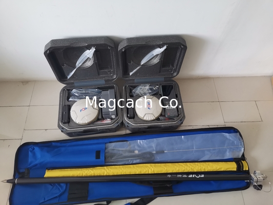
Foif A90 Gnss Rtk GPS 800 Channels 1408 Channels Tilt Survey Intelligent
Product Details:
Payment & Shipping Terms:
|

Detailed Product Description
| Name And Model: | A90 | Horizontal: | 2.5mm+0.5ppm RMS |
|---|---|---|---|
| Vertical: | 5mm+0.5ppm RMS | Transport Package: | Case And Carton |
| Channels: | 1408 | IMU: | Yes |
| Mian Board: | UM980 |
Foif A90 Gnss Rtk GPS 800 Channels 1408 Channels Tilt Survey Intelligent
Foif A90 Gnss Rtk Land Survey Rtk 1408 Channels with best price and tilt sensor and surpad 4.2 software
![]()
![]()
SPECIFICATION :
| SATELLITE SYSTEM | |
| Channels | 1408 |
| POSITIONINGT(POSITIONING) | |
| Horizontal | 2.5 mm+0.5ppm RMS |
| Vertical | 5mm+0.5 ppm RMS |
| Horizontal | 0.25 m RMS |
| Vertical | 0.45 m RMS |
| SBAS POSTIONING | |
| Horizontal | 0.30 m RMS |
| Vertical | 0.60 m RMS |
| REAL TIME LINEMATIC(<30KM)-NETWORK SURVEYING | |
| Fixed RTK Horizontal | 8 mm+0.5 ppm RMS |
| Fixed RTK Vertical | 15mm+0.5 ppm RMS |
| Initialization Reliability | > 99.9% |
| RTK Initialization time | 10s |
| Internal memory | 8GB Standard Supports extending to 32GMB |
| Tilt survey sensor | IMU |
| Operating system | *Based on Linux;Supports web UI Multi-language supported |
| Operation | *RTK rover/base, post-processing RTK Network rover:VRS,FKP,MAC Point-to-Point GPRS through Real-time Data Server Software (internal GPRS or external cell phone) Land XML(FOIF FieldGenius support) Total Station support (FOIF Field Genius) Import and stake directly from a DXF File (FOF Field Genius) |
| ITEGRATED GNSS ANTENNA | |
| High accuracy four constellation micro-strip antenna,zero phase center.with internal multipath suppressive board | |
| INTERNAL RADIO | |
| Type | Tx- Rx |
| Frequency Range | 410-470MHz |
| Channel Spacing | 12.5 KHz/125 KHz |
| Maximum Range | 3-4 Km in urban environment, |
| up to 10 Km with optimal conditions | |
| INTERNAL MODEM | |
| Band | GSM/GPRS/EDGE, |
| LTE/UMTS/WCDMA | |
| COMMUNICATION | |
| 1/0 Connectors | 7-pins.Lemo and 5-pinsLemo interfaces.Multifunction cable with USB interface for PC connection |
| Wi-fi | 802.11b/g/n |
| Web UI |
To upgrade the software,manage the status and settings, data download, etc. via smart phone, tablet or other internet enabled device |
| Reference outputs | RTCM2.1,2.3,3.0,3.1,3.2,3.3 |
| CMR CMR+RTCA NOVATELX | |
| POWER SUPPLY | |
| Battery |
7.2v,6800mAh removable battery Over 13 hours when simultaneous use of 2 batteries |
| Working Time | up to 12 hours (2 batteries hot swap) |
| Charge Time | Typically 4 hours |
| PHYSICAL SPECIFICATION | |
| Size | 156 mm*76 mm |
| Water/dustproof | IP68 |
| Temperature | Operating temperature -30ºC~ +60ºC |
| Storage temperature -40ºC~ +70ºC | |
| Humidity | 100% condensing |
| shock | 2m pole drop ,1.2m free drop |
Contact Details
Shanghai Magcach Technology Co.Ltd
Contact Person: Ms. Rebecca Zhou
Tel: +86-18221338069
Other Products
-
High Precision Classic Gnss Foif A70 PRO Rtk Intelligent Receiver
-
Foif A90 Gnss Rtk GPS 800 Channels Tilt Survey Intelligent
-
High Precision Classic Gnss Foif A70 Ar Rtk Intelligent Receiver Base Rover
-
China Brand FOIF RTK GNSS GPS A60PRO UM980 Main board tilt sensor
-
CHC B5/IBASE Integrated Professional Chc B5 Gnss Base Receiver UHF Base Station
-
Chc X1 Base Rtk Super Base Long Working Distance Professional Base with 5W Internal Radio