|
|
|
|
|
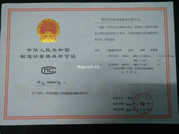
Certification
- I'm Online Chat Now
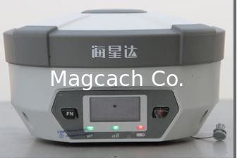
Hi-Taget H32 Gnss Rtk GPS Receiver with High Quality 220 Channel GPS Navigation
Product Details:
Payment & Shipping Terms:
|


Detailed Product Description
Hi-Taget H32 Gnss Rtk GPS Receiver with High Quality 220 Channel GPS Navigation
The H32’s housing is made of General Electric Xenoy 5220U polymer resin to handle severe and harsh filed conditions. With its unique internal design, it can perfectly avoid or lessen obstruction and multipath effect to ensure superior positioning capability.The H32’s front control panel with super bright OLED display screen (Resolution 128x64) makes the work more intuitive. No matter it is in the dark or strong sunshine, the screen is comfortably readable to eyes.
Multi Constellation Tracking
120 channels. The H32 is fully compatible with GNSS constellations to track GLONASS, GALILEO, SBAS as well as GPS.
All-in-one Transceiver UHF Radio
The transceiver UHF radio enables the H32’s working mode to be switchable between base and rover in the same receiver. The H32 provides excellent performance in UHF RTK operation with its built-in transceiver UHF radio, which has adjustable transmitting power from o.1 Watt to 2 Watts.
Seamlessly Operation in CORS System
With internal GPRS modem, the H32 works perfectly with corrections from CORS networks in any version of CMR, RTCM without needing to interpret the message but reading seamlessly.
Powerful Battery
Powered by 4400mAh Li-Ion battery.
Static working time 13 - 15 hours
RTK Rover (UHF/GPRS) working time 10 - 12 hours
RTK Base working time 8 - 10 hours
Rugged design, IP67
The special latching technology on flexible flat cables ensures trouble-free operation under impact or vibration. The H32 withstands 2 meters natural fall onto concrete.
Field Controller and Software
There are optional field controllers and software in the H32 package. The controllers with OS Microsoft Windows Mobile 6.5 are fully compatible with the third party software such as Carlson SurvCE, MicroSurvey FieldGenius, Digiterra Explorer, Esri ArcPad etc. besides standard field&GIS software made by HI-TARGET. HI-TARGET controller with WiFi, Bluetooth, and GPRS/3G is completely wireless to connect to any device, collect data and connect to server simultaneously and seamlessly.
Post-processing Software
HI-TARGET Geomatics Office (HGO) software provides total GNSS solution with a complete suite of programs to support HI-TARGET GNSS receivers. Standard Rinex data and HI-TARGET raw data can be processed flexibly and easily.
MEASUREMENTS
120 Channels
Proven NovAtel GNSS technology
Multipath mitigating technology
Auxiliary strobe signals, including a configurable output for time synchronization and mark inputs
Satellite signals tracked simultaneously
GPS: L1, L2, L2C
GLONASS: L1, L2
Galileo: E1
GIOVE-A/GIOVE-B (test)
BDS/Compass
SBAS
QZSS
POSITIONING PERFORMANCE[1]
Static and Fast Static GNSS surveying
Horizontal: 2.5mm+0.5ppm RMS
Vertical: 5mm+0.5ppm RMS
Post Processing Kinematic
(PPK / Stop & Go) GNSS surveying
Horizontal: 1cm+1ppm RMS
Vertical: 2.5cm+1ppm RMS
Initialization time: typically 10 minutes for base while 5 minutes for rover
Initialization reliability: typically > 99.9%
Real-time Kinematic (RTK) surveying
Horizontal: 10mm+1ppm RMS
Vertical: 20mm+1ppm RMS
Initialization time: typically < 10 seconds
Initialization reliability: typically > 99.9%
Code Differential GNSS positioning
Horizontal: 25cm+1ppm RMS
Vertical: 50cm+1ppm RMS
SBAS: 0.60m Horizontal
Contact Details
Shanghai Magcach Technology Co.Ltd
Contact Person: Ms. Rebecca Zhou
Tel: +86-18221338069
Other Products
-
Hi-Target Huaxing GNSS RTK GPS A12 High Configuration Product New Linux System for Surveying
-
HI-Target RTK GPS Huaxing A10 GPS Receiver for Survey
-
HI-Target RTK GPS Huaxing A8plus GPS Receiver for Survey
-
HI-Target RTK GPS V98 GPS Receiver with 16GB internal storage and OTG functions
-
CHC RTK GPS T5Pro GPS receiver
-
CHC RTK GPS I70 GPS receiver